0
2
5
7
9
0
7
9
7
9


.svg)


We are Advanced Aerial Mapping Services (AAMS), your go-to source for top-tier aerial mapping and geospatial solutions. With our headquarters based in Saudi Arabia and offices spanning the United Kingdom and South Africa, we're your trusted partner for innovative and customized services.
View More.webp)
.svg)
.svg)
.svg)
.svg)
.svg)
.svg)

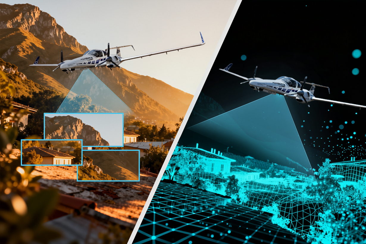
AAMS excels in surveys, seamlessly switching between agile drones and powerful manned aircraft, redefining excellence in every flight.

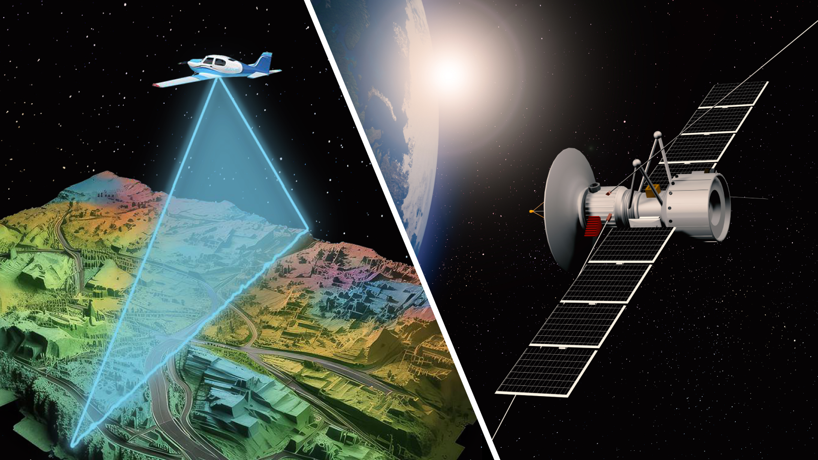
AAMS is a leading provider of satellite imagery, mapping, and remote sensing services, we support our clients with fast decision-making solutions.
.webp)
AAMS helps organizations maximize spatial and geographic data. Our team of GIS and drone survey experts specialize in LiDAR, photogrammetry, 3D modelling, site mapping, and enterprise data solutions.

Revolutionizing data collection with advanced mobile mapping technology, we ensure swift and precise surveys for a dynamic mapping experience.
.png)
Excelling in ground survey precision, we offer a spectrum of services from precise geolocation, establishment of GCPs, and topographical surveys to engineering and construction surveys.

Pioneering thermal imagery surveys for invaluable insights in infrastructure, energy, and the environment.

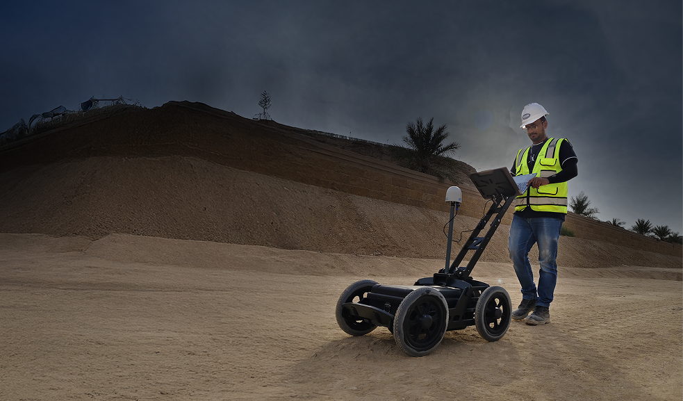
Accurate GPR survey solutions for detecting underground utilities and subsurface structures ensuring safer excavation and reduced project risk
Precise 3D laser scanning and BIM modelling for accurate digital representation and smarter project planning
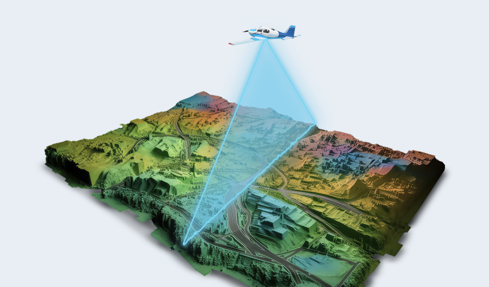
AAMS breaks barriers by offering aerial services through both manned aircraft and drones, setting a new standard for precision in Saudi Arabia and Globally.
.webp)
Our expertly tailored aircraft fleet ensures unrivaled accuracy and efficiency in aerial survey operations.

Leveraging state-of-the-art drone technology, our fleet is optimized for agile and versatile aerial survey missions.
.webp)

We provide the data and insights necessary to forge a cleaner, better, and more sustainable tomorrow. Join us in empowering the green transition and building a future defined by environmentally conscious solutions.
Discover a wealth of resources tailored to suit your unique requirements. Our fleet of specialized aerial survey aircraft and drones, coupled with cutting-edge sensors and seasoned professionals, ensures that every project is executed with precision and expertise. With our comprehensive suite of offerings, we empower you to overcome any geospatial challenge with confidence and ease.

Our fleet of specialized aircraft is equipped with advanced technology to efficiently gather aerial survey data over diverse terrains, ensuring accuracy and reliability in every mission.

The DA42 is celebrated for its versatility and reliability, making it the perfect choice for accessing hard-to-reach and remote areas with ease and precision.
163 knots max speed
Dual engine
1215 nautical miles max range

Renowned for its exceptional performance and versatility, the Aero Commander 690A is ideal for covering vast geographical areas with precision and efficiency.
Up to 215 knots max speed
1,600 nautical miles max range
Accommodates various sensor configurations for specialized aerial survey missions

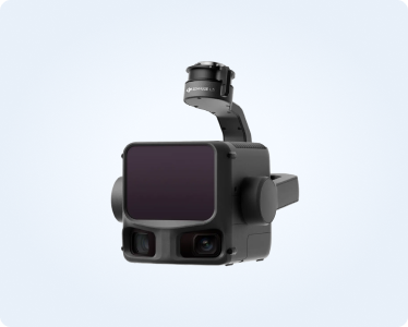
Capture high-resolution aerial images with our state-of-the-art airborne sensors, providing detailed and comprehensive coverage for mapping and analysis purposes.

The UltraCam Eagle M3 is renowned for its high-resolution imaging capabilities, delivering unmatched clarity and detail in aerial photography.
High-resolution imaging
Wide coverage
Advanced technology

The UltraCam Osprey 4.1 offers superior aerial photography for 3D city mapping, capturing both nadir and oblique imagery with photogrammetric precision.
Simultaneous nadir and oblique imagery
Photogrammetric-grade quality
Ideal for 3D city mapping

The RIEGL VQ-1560 II is one of the most versatile airborne laser scanners, featuring a unique cross-fire scan pattern and a wide operational range for diverse scanning applications.
Unique "cross-fire" scan pattern
Wide operational range
Versatile scanning capabilities

The RIEGL VUX-240 is a lightweight airborne laser scanner designed for use on UAVs and small aircraft, offering precise and efficient data collection for various mapping projects.
Lightweight design
Suitable for UAVs and small aircraft
Efficient data collection

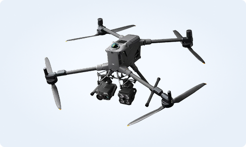
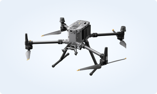
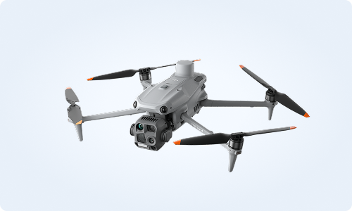
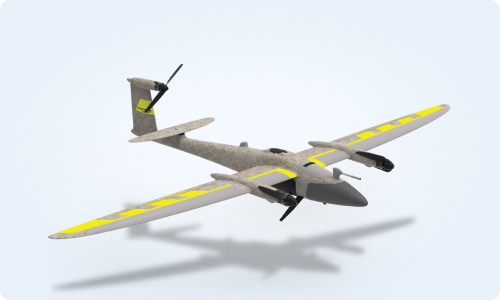
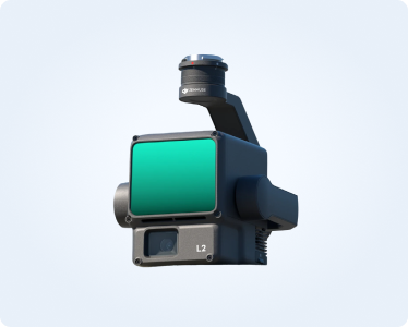
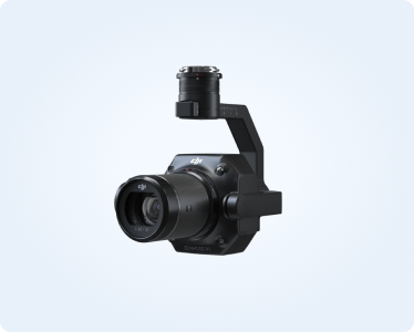
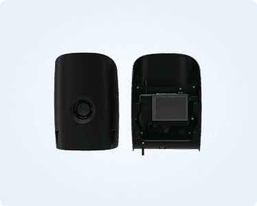
AAMS operates a versatile fleet of advanced drones designed to meet the demands of modern surveying and inspection projects. Our fleet includes several DJI M400 RTK, DJI Matrice 4T, and Quantum Trinity Pro VTOL systems, all equipped with versatile sensors. These platforms deliver exceptional accuracy, efficiency, and coverage across a wide range of applications, from high-precision topographic mapping and thermal diagnostics to large-scale corridor and area surveys. Engineered to capture rich, reliable data even in the most challenging environments, our drones combine industry-leading flight endurance, RTK/PPK precision, and multi-sensor versatility.
AAMS continually upgrades its fleet to stay at the forefront of technology, ensuring that every project is executed with unmatched speed, safety, and technical excellence.

.svg)
Our team is fully licensed and authorized by the General Authority of Civil Aviation (GACA) to operate drones for commercial purposes in Saudi Arabia and by CAA in the United Kingdom.
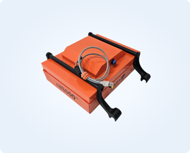

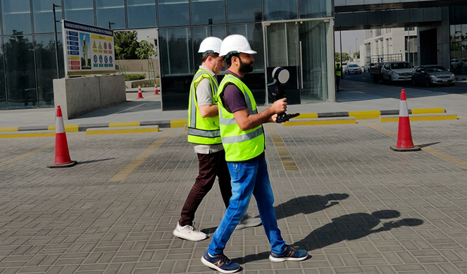
At Advanced Aerial Mapping Services (AAMS), we enhance our geospatial data acquisition capabilities through state-of-the-art mobile mapping and 3D laser scanning technologies. These systems allow us to capture high-accuracy spatial data in complex environments where traditional surveying methods are limited.
.png)
.png)
.png)

Our team is composed of highly skilled professionals dedicated to delivering top-quality survey solutions.
Our experienced (Manned Aircraft) Pilots ensure safe and efficient aerial survey operations.
While our Sensor Operators assist with flight navigation, mission planning, and optimize the performance of advanced airborne sensors.
With over 6 licensed Drone Pilots, each bringing extensive experience and are fully equipped to handle any survey project.
Our team of expert Land Surveyors, most with a minimum of 10 years in the field, provide invaluable insight and knowledge.
In addition, our Geomatics, Geodetic, GIS, and Surveying engineers are specialized inGeospatial data collection, data processing, analysis, and management and holding the relevant qualifications.
Our experienced Photogrammetrists specialize in processing and analyzing airborne data to produce precise Geospatial information.
This combination of expertise ensures we can tackle even the most complex projects with accuracy and efficiency.
Meet our valued partners and hear their success stories.

EGS (Asia) Limited, A World Leader in Geophysical Survey for over 45 Years, have appointed AAMS in March 2021 via a competitive bidding process, to provide "Topographical Survey and Cable landing services" for several project sites in Saudi Arabia.
All the work components of the project have been satisfactory executed and completed by AAMS team in accordance with the project specification.
I highly recommend Advanced Aerial Mapping Services Ltd as a professional, reliable and experts in topographical survey services.
Thank you for an excellent job.
Richard Poole | Snr. Projects Manager

In the spring of 2019, we engaged Advanced Aerial Mapping Services Ltd, to, provide high resolution colour aerial imagery, DEM and Orthophoto for a site in Eastern Europe. Although a complex project AAMS handled all matters professionally and swiftly, provided regular status reports and provided excellent quality data, allowing us to deliver to our client on time. The project was accepted first time allowing us to gain repeat business with a key client.
AAMS have become a key part of our team on a number of projects and are allowing us to expand our customer base as a result of their commitment and quality.
Tim Mellreavy | Managing Director

We (Sixense) contracted Advanced Aerial Mapping Services (AAMS) in early November 2022 to carry out Topo Survey work around the wider
Neom Trojena area.
From the commercial stage through to handing over of the data, Advanced Aerial Mapping Services' attention to detail, professional approach and commitment was second to none. AAMS team efforts, reactivity, flexibility and professionalism were instrumental in the delivery of a first-class project.
1 am hoping to appoint AAMS firm again, on further projects, and would happily recommend them to all.
Matthias Rabillet | Project Manager

TerraTopo is an established geospatial consulting firm and was founded in 2014 in Canada. Mr. Usman his team at Advanced Aerial Mapping services (AAMS) worked on a 3D city modelling project in the United Arab Emirates. AAMS was contracted to collect 130 post identification survey points to be used for mapping purposes. In addition to conducting the ground survey, AAMS generated an orthophoto at 7.5 cm GSD to be used as the base layer for the 3D city model. AAMS continuous attention to detail and adherence to the project schedule allowed for a superior product appreciated both my TerraTopo and the end client. Terratopo continues to work with AAMS on all sort of geospatial project both in the Middle East and North America.
Arjan Mooij | CEO
.png)
MAPSGEO sarl is a well-established and leading geospatial company in the Middle East and Africa. Founded in 1974 in Lebanon. Being a professional company, timing and quality are vital to our successful completion of projects. It's assuring to know that others take this same approach with their clients.
Mr. Usman and the team at Advanced Aerial Mapping Services (AAMS) have delivered data and photogrammetry services with precision and perfection each and every time we've relied on their services. With high-quality Data, a flexibility to meet differing requests, and a prompt and courteous delivery, AAM have helped in our closing of projects where we worked together and will continue to do so in the foreseeable future.
Hicham Zantout | Managing Director

We have thoroughly enjoyed working with the team at Advanced Aerial Mapping Services Ltd for one of our Aerial LiDAR project. The team is approachable and always available, and they understand the demands of delivering projects On-Time and as per specifications.
They have put together an excellent team of specialists as per our project requirement, their proactive approach has added value to each stage of the project and their team provide a very high-quality service.
We highly recommend AAMS's services.
Artur Jach | General Manager

Advanced Aerial Mapping Services Ltd (AAMS) has been contracted by WORLEY to perform "Acquisition of Digital Aerial Imagery & Airborne LiDAR Survey" for the project in Saudi Arabia. The AAMS team were professional and accommodating and worked hard to meet the tight timelines set out for this contract. Engr. Usman and his team were a pleasure to deal with and ensured that a quality product was completely to our satisfaction before turning over the space. I would happily recommend them as a trustworthy and sensibly priced
Aerial Survey Company.
Thank you for an excellent job - quick and efficient throughout the whole process.
Keep up the high standard!
Abdelaziz Rashed | Project Manager

From Riyadh to the World
Suite 28 - 29, First floor, Alwan Centre, King Abdul Aziz Road, Al Sahafa, Riyadh 13321, Saudi Arabia.
Mob: + 966 56 449 8544
Mob: + 44 7427 733 288
Scotts Road, Bromely, England, London BR1 3QD, United Kingdom
Mob: + 44 7427 733 288
Mob: + 44 2034 755 515
42 Sunbird Dr, Myburgh Park, Langebaan, 7357, South Africa
Mob: + 44 7427 733 288
Mob: + 966 56 449 8544

Your Ultimate Destination for Geospatial Industry Insights – Discover Your Next Favorite Read Here.


.webp)


.webp)
