


.svg)
Airborne Photogrammetry vs LiDAR: Choosing the Right Aerial Survey Technology
News |
Feb 4, 2026
Discover the key differences between photogrammetry and LiDAR, their advantages, and how AAMS leverages both technologies to deliver high-precision, reliable, and actionable geospatial data for complex terrains and large-scale projects.
Photogrammetry vs LiDAR: Which Aerial Survey Method is Right for Your Project?
At Advanced Aerial Mapping Services (AAMS), we help our clients turn complex landscapes into actionable insights. When it comes to aerial surveying with manned aircraft, two technologies often come up: photogrammetry and LiDAR. Both are powerful, but which one is right for your project? Let’s break it down.
What is Photogrammetry?
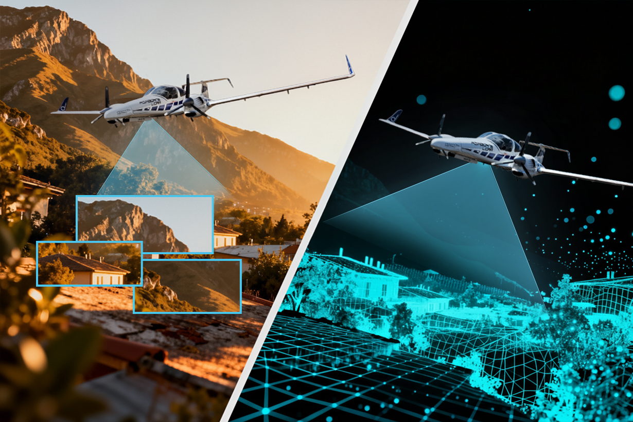
Photogrammetry captures high-resolution overlapping images from the air and uses advanced software to turn them into 3D models, orthophotos, and digital terrain models (DTMs). Think of it as creating a photo-realistic map of your area perfect for planning, visualization, and GIS applications.
Why Clients Perfer Airbone Lidar
Key Advantages:
- High-Resolution Visual Mapping: Photogrammetry provides detailed RGB imagery that captures textures, colors, and features accurately. This is essential for urban planning, real estate development, and infrastructure monitoring.
Example: A city municipality in Riyadh used photogrammetry to produce orthophotos of urban areas for land-use planning and to detect changes in building footprints over time. - Cost-Effective for Large, Accessible Areas: For projects without heavy vegetation or complex terrain, photogrammetry can cover large regions efficiently with a lower cost per square kilometer.
Example: A solar farm project in Tabuk used airborne photogrammetry to create detailed site maps for design and construction, minimizing fieldwork. - Rapid Visualization and Public Communication: The imagery is easy to interpret and can be directly used in presentations, marketing, or reports.
Example: Real estate developers in Jeddah leveraged photogrammetric orthophotos to show investors accurate visual representations of plots, roads, and surrounding features.
Things to keep in mind:
- Trees, shadows, or reflective surfaces can affect accuracy
- Needs good weather and daylight for the best results
What is LiDAR?
LiDAR (Light Detection and Ranging) uses laser pulses to measure distances and create high-density 3D point clouds. Unlike photogrammetry, LiDAR can “see through” vegetation, giving you true ground elevations even in forests or hilly terrain.
WHY CLIENTS PREFER AIRBORNE LIDAR
Key Advantages:
- Vegetation Penetration: LiDAR can capture the ground surface beneath trees, bushes, or crops, making it ideal for forestry, environmental studies, and flood modeling.
Example: The Saudi Ministry of Environment used LiDAR to map forested areas in Asir for biomass assessment and watershed modeling. - Accurate Topography for Engineering: LiDAR provides centimeter-level vertical accuracy, which is crucial for infrastructure design, road construction, and pipeline alignment.
Example: A major pipeline project in the Eastern Province relied on LiDAR data to generate a precise Digital Terrain Model (DTM), ensuring safe and efficient route planning through uneven terrain. Generate a precise Digital Terrain Model (DTM), ensuring safe and efficient route planning through uneven terrain. - All-Weather, Low-Light Capability: LiDAR systems are less affected by shadows, low light, or reflective surfaces, ensuring reliable data collection in challenging conditions. Example: AAMS captured LiDAR surveys for the NEOM project, accurately capturing coastal and desert terrain during early morning and evening flights, which overcame harsh sunlight angles.
Things to keep in mind:
- Visual details are lower compared to photogrammetry
- Generally, it is more expensive due to advanced sensors and processing
Quick Comparison
Why Use Manned Aircraft?
While drones are ideal for small-scale surveys, manned aircraft provide unmatched range, speed, and payload capacity, allowing us to carry high-end photogrammetry cameras and LiDAR sensors over large or hard-to-access areas. For national-scale projects, complex terrains, or sites requiring high precision, manned aircraft are the smarter, more efficient solution.
At Advanced Aerial Mapping Services (AAMS), we operate a fleet of specialized aerial survey aircraft, including the Diamond DA42 and AeroCommander 690. These platforms enable us to capture high-quality geospatial data over challenging terrain, fly at lower speeds for enhanced accuracy when required, and accommodate advanced sensors for both photogrammetry and LiDAR missions.
Notably, one of our aircraft is primarily based in Saudi Arabia, ensuring rapid mobilization and timely deployment for on-site surveys whenever the project demands.
By leveraging manned aircraft, AAMS ensures faster coverage, superior data quality, and reliable results, even in the most demanding environments.
How AAMS Helps You
We don’t just fly planes; we deliver insights that drive decisions. Whether your project benefits more from photogrammetry or LiDAR, our team of pilots, surveyors, and GIS experts ensures that every dataset is accurate, reliable, and ready for action.
Bottom Line
Photogrammetry or LiDAR? The answer depends on your project needs, terrain, and data requirements. At AAMS, we help you choose the right technology and deliver high-quality geospatial data that you can trust.
Related News
all News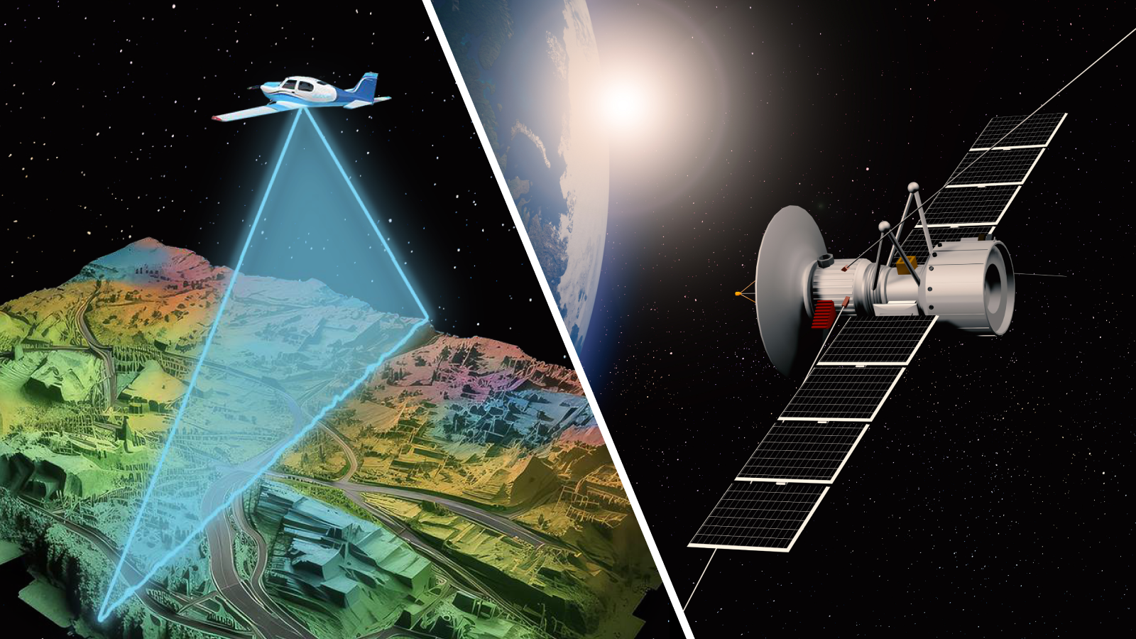
.svg)


