.svg)
Aircraft Aerial Mapping VS Drone Aerial Mapping
News |
May 2, 2024
.webp)
Aerial mapping has become an essential tool for variety of industries such as construction, agriculture, and surveying. The two primary methods of aerial mapping include drone and aircraft aerial mapping. Although both the methods have their own unique benefits, they also have significant differences.
In this blog, we will delve deeper into the differences between drone and aircraft aerial mapping.
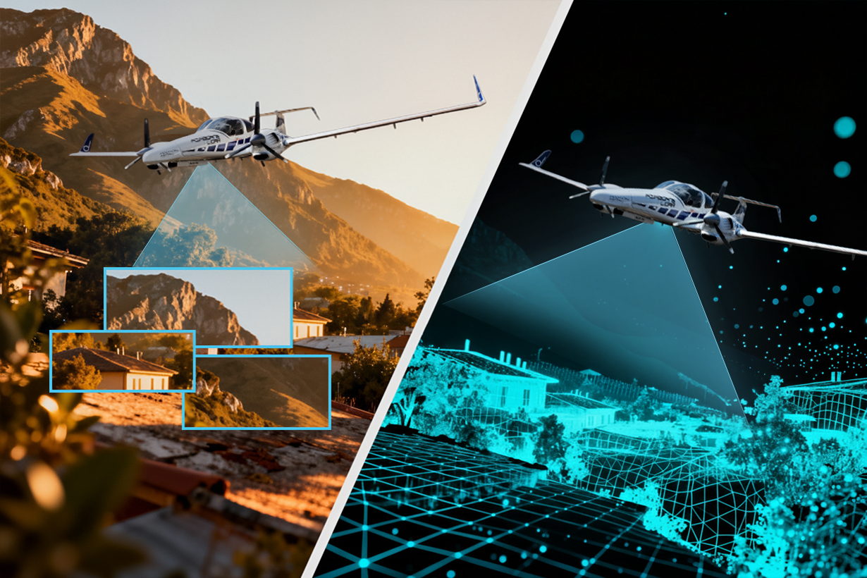
Aircraft Aerial Mapping:

Aircraft aerial mapping has been in use for much longer than drone aerial mapping.
This method involves using manned aircraft equipped with powerful Digital cameras and sensors to capture images and data from a particular area.
The aircraft fly at higher altitudes than drones and can cover large areas quickly, making them ideal for larger-scale projects.
One of the primary benefits of aircraft aerial mapping is its speed and efficiency. Aircraft can cover vast areas quickly and efficiently, making them ideal for projects that require data to be captured over a vast expanse of land. Additionally, aircraft are equipped with more powerful cameras and sensors than drones, allowing them to capture high-quality images and data from higher altitudes
Advanced Aerial Mapping Services (AAMS) operates the following cameras and sensors for aircraft aerial mapping;
At AAMS we utilise Vexcel-Imaging’s UltraCam Eagle Mark 3 and UltraCam Eagle 4.1, Most versatile photogrammetric large-format aerial camera for true mapping-grade image quality and accuracy. We also use IGI DigiCam 150 Large Format Aerial Camera System with Diamond Da42 aircraft.
For Oblique aerial imagery, we utilise The UltraCam Osprey 4.1 large format aerial camera to collects photogrammetry-grade nadir and oblique images simultaneously with Aero Commander 690 A.
This enabling AAMS unprecedented flight collection efficiency at industry-leading image and data quality.
The UltraCam Eagle 4.1 is a cutting-edge imaging system that can capture high-resolution information in panchromatic, R, G, B, and NIR formats, at an impressive cycle rate of 1 frame per 0.7 seconds, resulting in over 500 Megapixels. This makes it the ideal choice for the AAMS aviation team, as we require maximum accuracy and efficiency in our aerial imaging projects.
Besides Digital Aerial cameras, AAMS team also utilise RIEGL VUX-240 Airborne Laser Scanners for LIDAR data acquisition for large project areas that installed in manned aircraft such as Diamond DA42. The RIEGL VUX-240 is a lightweight airborne laser scanner, especially designed for use on manned aeroplanes or helicopters.
Drone Aerial Mapping:

Drone aerial mapping is a relatively new technology that has been gaining popularity in recent years. Drone aerial mapping involves using unmanned aerial vehicles (UAVs) equipped with cameras and sensors to capture high-resolution images and data of a particular area.
The drones are usually flown at low altitudes and can capture images from various angles, providing a comprehensive and detailed view of the area.
One of the main benefits of drone aerial mapping is its flexibility. Drones can be launched and operated quickly and are ideal for capturing data in tight spaces and hard-to-reach areas. Additionally, drones are relatively inexpensive compared to traditional aircraft, making them a cost-effective option for small-scale projects.
At AAMS we utilise M350 RTK with P1 and L2 sensors for the areas which are in the range of 1 to 30 Sq.km and depending on project requirements, the Matrice M350 RTK which has a maximum flight time of 55 minutes and supports multiple payloads, adding innovation to our aerial operations.
Whereas for comparatively large areas such as over 30 and less than 500 Sq.km we use Quantum Trinity Pro. The Trinity Pro system gives our team the flexibility to fly which has a maximum flight time of 90 minutes and allow our team to choose from five different fully integrated cameras, including RGB, oblique, multispectral, and LiDAR.
These cameras can be easily swapped using the quick-lock mechanism in the payload compartment. The system architecture also enables simple integration of next-generation cameras and streamlined workflows downstream.
Key Differences:
The main differences between drone and aircraft aerial mapping are the altitude at which they operate and the scale of the projects they are suited for. Drones are ideal for small-scale projects that require a detailed and comprehensive view of a particular area.
On the other hand, aircraft are better suited for larger-scale projects that require data to be captured over vast areas quickly and efficiently.
Conclusion:
In conclusion, both drone and aircraft aerial mapping have their benefits and are ideal for different types of projects. When deciding which method to use, it is essential to consider the scale of the project, the level of detail required, and the budget available.
With the right planning and execution, both methods can provide valuable insights and data to various industries.
Related News
all News
.svg)